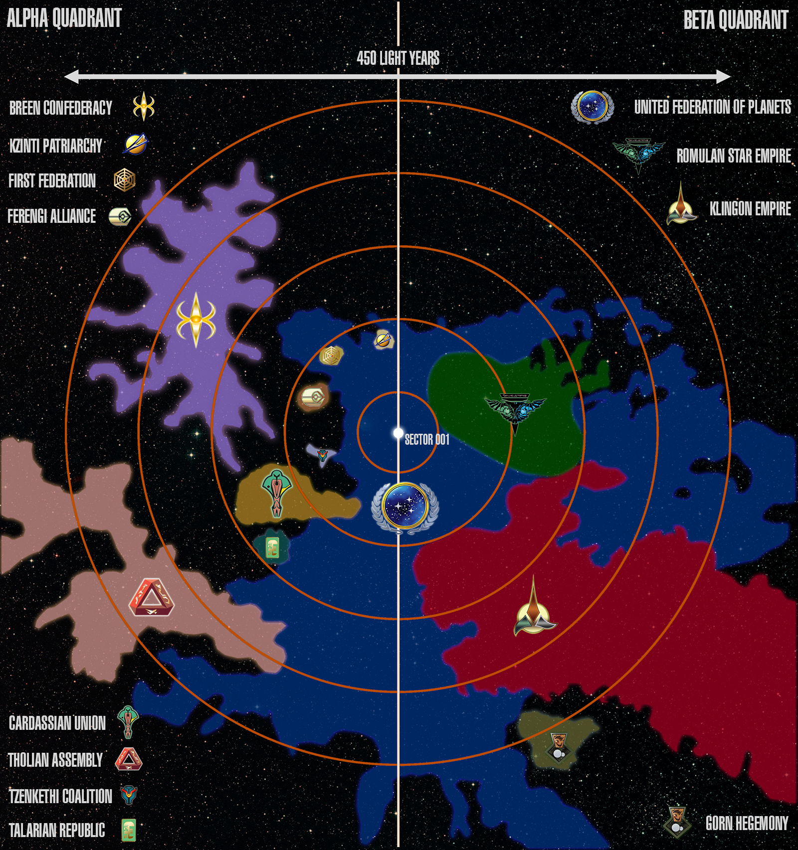
POLITICAL MAP
This simplified map shows a section of the Milky Way Galaxy. The map covers an area approximately 500 light years across, centered on Sector 001 (Sol Sector) with the left and right sections showing the Alpha and Beta Quadrant respectively. The map is flattened for two-dimensional representation.
The borders shown for political entities are approximate, as in three-dimensional space many regions of control overlap. Similarly, the size of each entity's space is based on an approximate cross-section that most closely matches the maximum extent of the entity along the x- and y-axis on the galactic plane. This should not be considered an accurate representation of the overall volume of the political entity's space, as many entities, such as the Gorn Hegemony, cover great distances along the z-axis.
Not all political entities in the region are represented on this map. Those selected represent the major powers bordering the United Federation of Planets as well as those smaller powers that still contain multiple star systems and have regular interaction with the Federation. Details on these political entities can be found in the Alpha Quadrant and Beta Quadrant sections.
Use the zoom function to view enlarged sections of the map.